Wednesday, August 10, 2016

August 10 - Castella


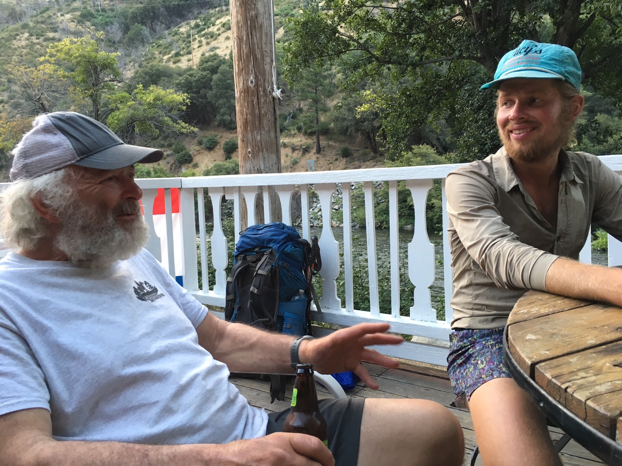
I think I just had two Lagunitas IPAs, a Fosters in the big can, and a bag of Hanover Honey Mustard Pretzel Chips for dinner. Revise that, also a pint of Bodington's and a bag of potato chips. 

It's 9:09 pm and I've just finished a punishing uphill battle followed by a downhill slide to make 19+ miles into Castella, California. Hiker hunger is real! When we get to town it's the food we can or won't carry that we crave. Salty and savory!


Domestix and I got up before the sun and passed several members of the sleepy Fastwalker Gang on our way uphill. Before we reached the top in 7 miles we were passed by some of the Gang, only to catch up with a couple at a water spot. In the end the hare beat the tortoise to town, but only barely. 


Along the way we passed over the Sacramento River and under I-5. Castella, like most small towns on the PCT doesn't have much to offer, but we're happy nonetheless. 


Domestix on the bridge over Fitzhugh Creek. 


A great swimming hole. Too bad it was morning and about 50 degrees out. 


Interstate 5 - Woo Hoo!


Shasta in the distance


I-5. A milestone. 


Only 1113 miles to go. Not so daunting now. :-)


Hikingsolo

August 9 - On The Fast Track


We decided to leave early this morning to try to make some miles so we could be in Castella before the store closed. Ammarati's Market will be holding my resupply box, new Superfeet, a new bottom cover for my Jetboil, and some new socks. I'm so excited! I'm sure they'll also have salty snacks and beer. 


We made or first 13 miles before lunch mostly due to the downhill grade. The McCloud River was cold, but refreshing. Domestix washed a few clothes and tried fishing while I hung out with the Fastwalker Gang (my name for them as they all walk at least 3.5 miles per hour) and had lunch. It's funny, but we took more time and ended up in the same spot they did tonight. Go figure. We're camped in a gully in the forest. We're hoping it doesn't rain as there are no spots that aren't in the bottom of the gully. Tomorrow it will be hard to get up as the light hardly penetrates the trees. 


Campsite


Looking up the McCloud River. 


On the bridge over the river. 


Hikingsolo

Tuesday, August 9, 2016

August 8 - Can We Eat That?


Today we hiked from Clark Spring at mile 1434 to Golden Creek at mile 1455 near Grizzly Peak. Along the way we talked mostly about food. Domestix's favorite is Calabacitas, or squash soup with corn and chiles. However, along the way we sampled from the forest smorgasbord. Yesterday it was blackberries. Today it was Thimble Berries. We saw lots of other plants we couldn't identify but wondered if they were edible by humans? Here are a few pictures along with some scenery. 


Hikingsolo

Monday, August 8, 2016

August 6 - Burney Falls State Park


We woke up to Dainty singing 'Here comes the sun, do do do do,' as the sky lightened. It turns out Dainty, who is not at all dainty, was trained as a classical vocalist. She can sing amazingly well. 


After breakfast Domestix and I hit the trail again to come down off the Hat Creek Rim and make our way through pastures and mixed forest towards Burney Falls State Park. Along the way we met Pretty Boy who had just finished a 50 mile day. Later we were passed by other hikers who were working on 30 mile days. I felt fine with my last three days of 18, 23, and 21; fifty was way too much. 


Just after lunch time we came across a great example of trail magic set up with a picnic table and shade. Cold sodas, water, and snacks awaited hikers. 


Towards dinner time we walked into the hiker campground at Burney Falls and set up camp. Shortly after we walked to the store and picked up change for a shower and a few snacks (beer, chips, etc). Once cleaned up we headed back to camp and greeted Speedy Gonzales and Samples as they arrived after sunset. We talked a bit before turning in. 


Dainty getting up from her cowboy camp. 

Cow pastures. 


Trail Magic in the woods. 


Burney Falls. 


Hikingsolo

August 7 - Shasta Looms Large


We left the state park after a slow breakfast. Domestix shins were hurting so we planned a short day. As it turned out we missed a water source and had to settle for a 19 mile day. Along the way we got a great view of Mt. Shasta in the distance. We should be there in a few days. 


V-Dub joined us for a snack later in the day. Her trail name is from Vitamin W, or whiskey, which she carries in the right pocket of her pack. She's a slight figure with a strong understated personality. At home in Colorado she lives in a 'tiny house' built on a trailer bed so it can move easily. As an artist she is trying to live frugally and off the grid. I suppose the vitamin W helps her cope. 


Hikingsolo

August 5 - Hat Creek Rim


The day started by getting up in the trees behind the gas station where Domestix and I camped the night before. We packed up just in time to walk through the woods to JJ's Cafe where we joined five locals and seven hikers for breakfast. 


After breakfast Domestix and I hit the trail up Hat Creek Rim where there is no creek and only a fantastic view of the valley below. The rim is mainly volcanic rock that rises over 1000 feet over a flat valley that was devastated in an early 1900's eruption of the Lassen volcano. The 29 mile long rim itself is dry, but eight miles in there is a trail that takes one down 400 feet below to edge to Lost Creek where a spring provides plenty of cold water. Then another eight miles further there is a water cache stocked in the last week by Devil Fish. We took enough water there to camp a few miles down the trail. Dainty joined us as the sun set alongside Mt. Shasta. 


Climbing back up the trail. 


Sharing lunch with Blue Cheese and Schweaty Balls (hidden behind her).


Domestix at the water cache. 


More water. 

Sunset. 


Hikingsolo

August 4 - Old Station


I got up early, but not as early as Vitamin-W. She had her tent down and was on her way out of the campground as I was heading to the toilet. We stopped briefly to talk and make sure she was going the right direction before I did my business. 


I was next out of the campground and headed up the hill. Later I learned that I probably passed within feet of a bear hanging out on the hillside. That report came from the hiker that was third on the trail, Dainty. I spent most of the day walking quickly between grassy and sandy slopes. In the end there was little to see until leaving Lassen National park. Much of the forest had burned years ago. 


Hikingsolo

Saturday, August 6, 2016

August 3 - Drakesbad


Walking north from highway 36 you enter Lassen National Forest where the trail is mostly flat and easy. Some miles into the walk you enter Lassen Volcanic National Park, but you'd never know it unless you saw the sign as the landscape doesn't change. That is, the physical landscape stays the same, but the olfactory landscape definitely gives you strong clues that you've entered an active geologic region. The sulfur rotten egg smell is apparent miles before encountering the boiling stream and geyser or the Boiling Pot Lake. As I passed these features the number of tourists on the trail increased with each passing mile. In the vicinity of Drakesbad Guest Ranch the tourists took over the walkways and trails until I reached the resort dining area where I was to pick up my resupply package. The kids from the Czech Republic here on work visas were happy to help me retrieve my box and get me beer and ice water. The boss came by later with the trail register and an offer of all-you-can-eat dinner until it's gone which I was happy to sign up for. Other hikers soon arrived and we sat around talking about hiker things; who did we see, where was our last resupply, how was Chester, what's next on the trail, where to get a beer, how hot is the pool, what's for dinner? 


I signed up for a campsite at the National Park camping area and invited anyone who was staying to join me and Domedtic down there. After an awesome barbecue dinner followed by a ranger talk we sat around the campfire until the guests retired. Then, in response to a rousing political discussion Dainty suggested we exit for the pool and go for a swim. About ten of us did so. When the manager showed up to shush us we headed for the campground. In the morning bodies littered the landscape as many slept in. 


Boiling Pot Lake


Outside dining and beer garden. 


Ranger talk. 


Hikingsolo

August 2 - Chester


Chester is a small town near where the PCT crosses highway 36. The people driving this stretch of road seem very familiar with thru hikers because no one seemed to have to wait more than 10 minutes to get a ride into town. Our ride was a bit unusual in that he had two young children in the car along with a giant Rottweiler named Kona and Tortoise babies. We crammed into the back seat and he loaded our packs then dropped us at the Best Western. That started our zero day. 


Breakfast was included and I had the usual eggs, potatoes, and sausage covered with gravy along with toast, a strudel, coffee, and orange juice. 


Next I went in search of a gas canister at the local hardware store. They didn't have one but the sports store across the street did. I stopped at the grocery store, on the other side of the street, and picked up a few items for the trail. Then it was back to the hotel to eat lunch. After a banana, orange, and  bagel with cream cheese I went in search of a barber. 


The barber was located in the 'other' part of town, across the bridge. A three minute walk took me to his door. Inside all of the regular chairs were occupied so I sat in the extra barber's chair until a customer left. And hour, or two "Leave it to Beaver" episodes later I was trimmed up and the seats were still full. 


Back at the hotel I collected Rocky and we went to the local greasy spoon for dinner. She had baked chicken breasts and I had chicken fried steak. Neither of us really liked our dinner and were happy to return to the hotel for a quick swim in the hot tub. We talked for a long time with a nice couple from Southern California who were interested in our adventures. Next we watched a movie on HBO and called it a night. 


I'm planning on being up early to hit the trail. Rocky's sleeping in and starting a a slower pace to make sure her knees are better. I may or may not see her again as we'll be traveling at different paces. 


The 'Before' picture. 


Hikingsolo

Tuesday, August 2, 2016

August 1 - Halfway


Today I passed the (almost) Halfway Monument. Almost because the marker is at 1320.66 and halfway is now 1325.05. Nevertheless, I passed the correct mileage before hitching a ride into Chester for some R&R. Halfmile says that even if we're not finished the Halfway point is quite an accomplishment and we should feel good about our efforts. I do feel good about my effort. No celebration however. I'll leave that until I'm home with friends and family. 


A little dusty and dirty but I made it halfway. Now it would be nice to get out of California!


Hikingsolo

Sunday, July 31, 2016

July 31 - Reese and Rocky


It's a small world. Back on April 10th while making camp at the end of a day of hiking from Agua Dulce to Bouquet Canyon we met up with Reese and his friend Howard. They were completing a southbound section and camped near us. They also camped right next to a geocache Betsy had found a few days earlier, and lo and behold Reese found it by accident! He wasn't quite sure what it was, but when Justin and I came looking for it we explained what it was. Well, yesterday Rocky and I met up with Reese and another friend, also a Rocky. Reese remembered me from my unique trail name. Today we met up again and exchanged some more information. It turns out that he knows of the Reiss's because he used to work in student services at Humbolt State College. What a small world we live in. 


Rocky in yellow and Reese on the right. 


Reese will be finishing the PCT tomorrow after thirty five years on the trail doing a section here and another there. He has mixed feelings about finishing after so many years. He doesn't want it to end but realizes it can't go on forever. I say 'Congratulations' and there must be another challenge out there somewhere. 


Tonight Rocky (German girl Rocky) and I are camped near the top of Butt Mountain in preparation for a downhill walk that will take us to the halfway marker and Chester, California for some resupply and R&R for Rocky's knees. 


Hikingsolo

July 30 - A Climb to Remember


Whitney was just plain tough, mostly because of the elevation, but also because the trail was a jumble of rocks at the top making it difficult to walk. Forester Pass was just plain scary with that snow chute at the top - one misstep and the rocks below would break you up. The ups and downs in Yosemite make it one of the hardest and most beautiful sections of the PCT. 


That said, the walk out of Belden away from the North Fork of the Feather River made me glad I had done all of those previous climbs and descents. I feel I definitely have trail legs now and can tackle some of the hardest ascents and descents on the PCT without stopping for anything but food or water. Rocky and I knocked out a 5000 foot climb in just over thirteen miles with only a couple of flatfish spots along the way. With the steady upward slope we were happy to get to the top of the ridge and find our way another 6 miles to our camp spot. Oh, and we passed the 1300 mile marker today. 


New forest to explore. 


Rest break. 

Flowers at one of the flattish spots!

1300


A diamond trail marker. Written on others today:


Infowars.com - The Fox News source for the Bernie set. 


Picturesque 

Crustacean 

Tyranny 


Hikingsolo

Friday, July 29, 2016

July 29 - Rave at Belden Town


It was not totally unexpected, but also not something you can prepare for if you don't know what it is. Rocky and I had heard rumors of a Rave happening at Belden Town from some other hikers hurrying that way. Today we confirmed it was happening as we started down the five mile four of joys and foot descent to the North Fork of the Feather River. We could hear the bass from at least five miles up the trail. As we neared town the higher notes also became clear. Once across the railroad tracks we encountered lots of non-PCT tenters - you know the kind: big and cheap; those you put the relatives kids in out in the backyard when they come to visit and there aren't enough beds. There were also lots of vendors selling everything from Artistic Impressions to skimpy swimming-like-suits. The music was EDM - electronic dance music that got its stay on the internet. Once the artist gets enough recognition they might get invited to 'play' at an event like this. There were several stages and even participants could play on one. Cost? Somewhere around $200 per person, but free to PCT hikers since we have to come through town! There's only one bridge across the river and it's our only way out. 

Rocky coming across the top of the mountain above Belden. 


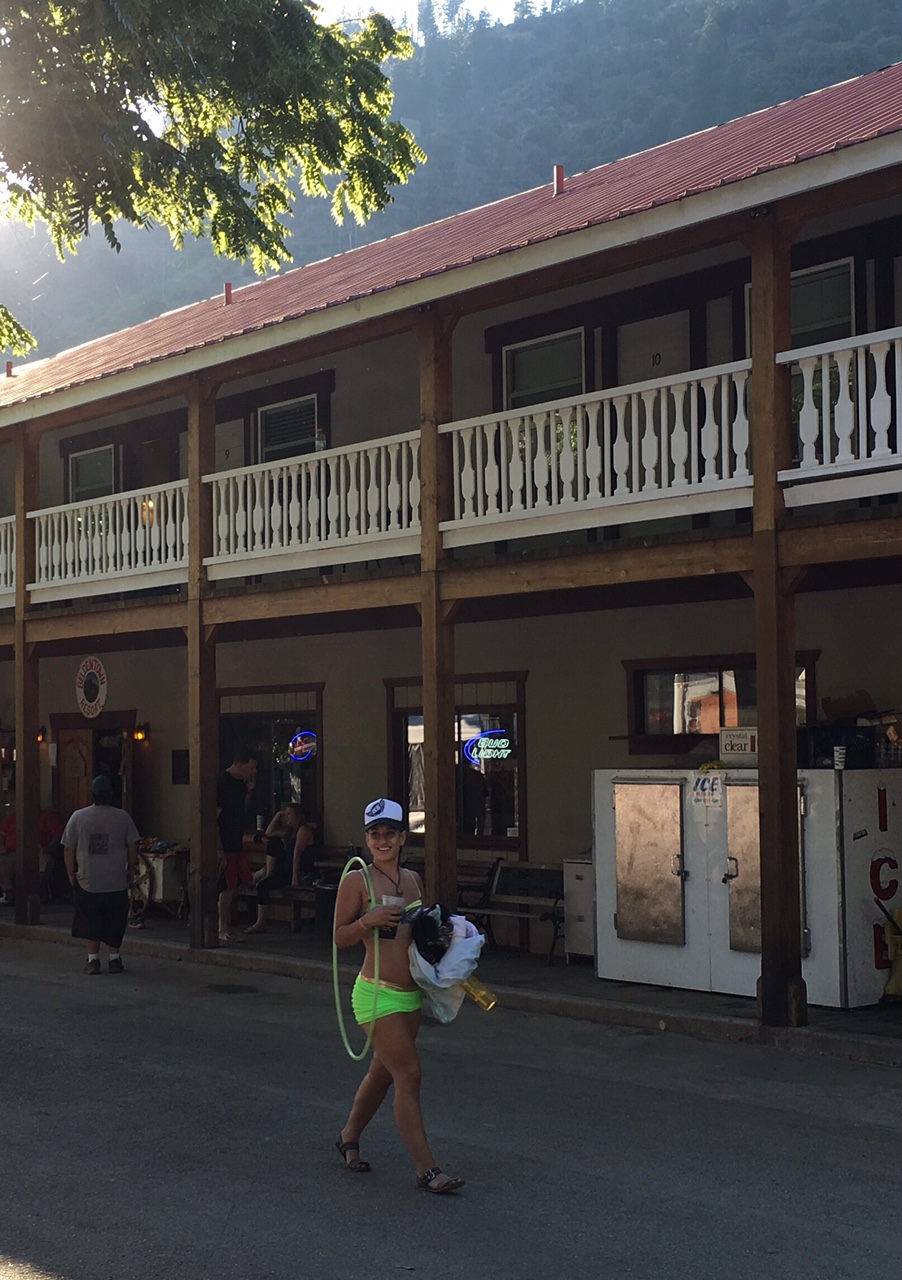
Belden Resort with a Raver walking by. 


Raver with baby in headphones in front of sound stage. 


The way out. 


Raver River. 


Hiker hanging out with us. Volunteering to wash dishes for food. 


BTW - we camped a mile up trail and could still hear the music!


Hikingsolo